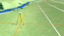
Geodetic Survey
Geodetic surveys are conducted with highest degree of accuracy to provide widely spaced control points on the earth surface for subsequent plane surveys. Provision of such con- trol points is based on the principle of surveying from the whole to the part and not from the part to the whole, as stated earlier.
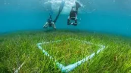
Environmental Study
the process used to predict the environmental consequences (positive or negative) of a plan, policy, program, or project before the decision to move forward with the proposed action. Formal impact assessments may be governed by rules of administrative procedure regarding public participation and documentation of decision making and may be subject to judicial review.
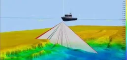
Hydrographic Survey
The science of measurement and description of features which affect maritime navigation, marine con- struction, dredging, offshore oil exploration/drilling and related activities. Strong emphasis is placed on soundings, shorelines, tides, currents, sea floor and submerged obstructions that relate to the previ- ously mentioned activities.
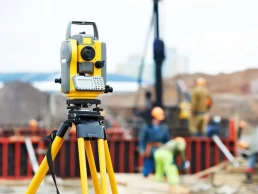
Topographic Surveys
Includes plotting the features of the land, using modern measuring instruments (theodolites or satellite receivers) and calculations to work out the exact positioning of physical features and contour lines
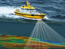
Bathymetric Surveys
Bathymetric surveys are generally conducted with a transducer which both transmits a sound pulse from the water surface (usually attached to a boat) and records that same signal when it bounces from the bottom of the water body. An echo sounder attached to the transducer filters and records the travel time of the pulse. At the same time that the pulse occurs, a GPS unit can record the location of the reading. After many of these readings are taken, corrections are made based on fluc- tuations in the water surface eleva- tion that may have occurred during the survey. The individual points are then mapped; easily done in a GIS.
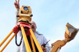
Stakeout Surveys
These surveys are normally required during the construction of Roads, Pipelines, Concrete frames, Housing developments and many more Cadastral Survey: surveys that create, mark, define, retrace, or reestablish the boundaries and subdivisions of the lands of Maldives
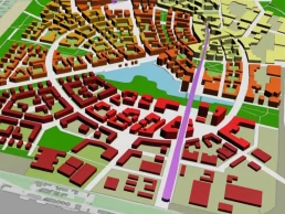
Land Use Plans
A branch of urban planning encom- passing various disciplines which seek to order and regulate land use in an efficient and ethical way, thus preventing land-use conflicts. Governments use land-use planning to manage the development of land within their jurisdictions. In doing so, the governmental unit can plan for the needs of the community while safeguarding natural resources.
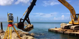
Coastal Engineering
While there are a number of sys- tems that Coastal Engineers use to prevent damage caused by waves, the most common are breakwaters, sea walls, revetments and gryones. These are all structures built out of concrete, sand and stone to help dis- sipate the force of waves and control erosion. Many times, these “hard techniques” are mixed with “soft techniques” such as beach replenish- ment, where sand is dredged from the sea bottom and deposited on the beach to replace sand that has been washed away by the waves.

Built Environment
The layout of built environments is a rich source of spatial data. If we are to understand the signiicance of
the physical presence of these spa- tial properties to the social develop- ment of the residing society we need to move beyond a purely empirical representation and quantitative analysis of acquired spatial data. They form the basis of an emergent comparative methodol- ogy of restructuring spatial datasets which will permit the interpretive use of GIS analyses of built environ- ment conigurations in the future.